


Bonneville County--Idaho Falls City PUMA, Idaho
About
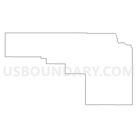
Outline
Summary
| Unique Area Identifier | 192782 |
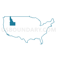
| Name | Bonneville County--Idaho Falls City PUMA |
| State | Idaho |
| Area (square miles) | 1,900.64 |
| Land Area (square miles) | 1,866.08 |
| Water Area (square miles) | 34.56 |
| % of Land Area | 98.18 |
| % of Water Area | 1.82 |
| Latitude of the Internal Point | 43.39517080 |
| Longtitude of the Internal Point | -111.62187830 |
Maps

Graphs
Select a template below for downloading or customizing gragh for Bonneville County--Idaho Falls City PUMA, Idaho


Neighbors
Neighoring Public Use Microdata Area (by Name) Neighboring Public Use Microdata Area on the Map
- Bingham (Outside Fort Hall AIR), Madison, Jefferson, Fremont & Teton Counties PUMA, ID
- Sheridan, Park, Teton, Lincoln & Big Horn Counties PUMA, WY
- Southeast Idaho--Pocatello, Chubbuck Cities & Fort Hall Reservation PUMA, ID
Top 10 Neighboring County (by Population) Neighboring County on the Map
- Bonneville County, ID (104,234)
- Bingham County, ID (45,607)
- Madison County, ID (37,536)
- Jefferson County, ID (26,140)
- Teton County, WY (21,294)
- Lincoln County, WY (18,106)
- Teton County, ID (10,170)
- Caribou County, ID (6,963)
Top 10 Neighboring County Subdivision (by Population) Neighboring County Subdivision on the Map
- Idaho Falls CCD, Bonneville County, ID (95,095)
- Rigby CCD, Jefferson County, ID (16,274)
- Afton CCD, Lincoln County, WY (12,578)
- Shelley CCD, Bingham County, ID (8,203)
- Ucon CCD, Bonneville County, ID (6,125)
- Victor CCD, Teton County, ID (5,043)
- Lewisville-Menan CCD, Jefferson County, ID (4,096)
- Driggs CCD, Teton County, ID (3,385)
- Atomic City CCD, Bingham County, ID (2,679)
- Mud Lake-Hamer CCD, Jefferson County, ID (2,338)
Top 10 Neighboring Place (by Population) Neighboring Place on the Map
- Idaho Falls city, ID (56,813)
- Ammon city, ID (13,816)
- Lincoln CDP, ID (3,647)
- Iona city, ID (1,803)
- Ucon city, ID (1,108)
- Ririe city, ID (656)
- Alpine Northwest CDP, WY (244)
- Irwin city, ID (219)
- Swan Valley city, ID (204)
Top 10 Neighboring Unified School District (by Population) Neighboring Unified School District on the Map
- Idaho Falls School District 91, ID (56,313)
- Bonneville Joint School District 93, ID (45,322)
- Madison School District 321, ID (33,461)
- Jefferson County Joint School District 251, ID (22,316)
- Teton County School District 1, WY (21,294)
- Lincoln County School District 2, WY (13,408)
- Teton County School District 401, ID (10,170)
- Shelley Joint School District 60, ID (9,417)
- Snake River School District 52, ID (7,898)
- Soda Springs Joint School District 150, ID (4,338)
Top 10 Neighboring State Legislative District Lower Chamber (by Population) Neighboring State Legislative District Lower Chamber on the Map
- State House District 32, ID (56,073)
- State House District 34, ID (49,686)
- State House District 31, ID (45,173)
- State House District 35, ID (43,409)
- State House District 28, ID (41,905)
- State House District 33, ID (38,893)
- State House District 22, WY (12,218)
- State House District 21, WY (10,966)
- State House District 23, WY (9,763)
Top 10 Neighboring State Legislative District Upper Chamber (by Population) Neighboring State Legislative District Upper Chamber on the Map
- State Senate District 32, ID (56,073)
- State Senate District 34, ID (49,686)
- State Senate District 31, ID (45,173)
- State Senate District 35, ID (43,409)
- State Senate District 28, ID (41,905)
- State Senate District 33, ID (38,893)
- State Senate District 16, WY (23,184)
- State Senate District 17, WY (19,969)
Top 10 Neighboring 111th Congressional District (by Population) Neighboring 111th Congressional District on the Map
Top 10 Neighboring Census Tract (by Population) Neighboring Census Tract on the Map
- Census Tract 9604, Jefferson County, ID (10,912)
- Census Tract 9704.03, Bonneville County, ID (10,426)
- Census Tract 9601, Teton County, ID (10,170)
- Census Tract 9714, Bonneville County, ID (8,508)
- Census Tract 9501, Bingham County, ID (8,203)
- Census Tract 9705.01, Bonneville County, ID (7,582)
- Census Tract 9603, Jefferson County, ID (7,143)
- Census Tract 9780, Lincoln County, WY (6,801)
- Census Tract 9713.01, Bonneville County, ID (6,443)
- Census Tract 9703, Bonneville County, ID (6,125)
Top 10 Neighboring 5-Digit ZIP Code Tabulation Area (by Population) Neighboring 5-Digit ZIP Code Tabulation Area on the Map
- 83401, ID (37,966)
- 83221, ID (27,021)
- 83402, ID (26,069)
- 83404, ID (21,606)
- 83442, ID (19,250)
- 83406, ID (15,902)
- 83274, ID (9,246)
- 83455, ID (4,970)
- 83014, WY (3,595)
- 83236, ID (2,275)